Aditi Dave has spotted snapshots of prehistory in sand grains embedded in blocks of mud extracted from paleochannels — the dried up routes of ancient rivers — in northwestern India. In experiments at the Physical Research Laboratory (PRL), Ahmedabad, Dave applied advanced dating techniques to determine when those grains had been deposited in the channels. And her findings challenge the long-entrenched idea that settlements of the ancient Harappan civilisation were clustered exclusively along — and owed their existence to — mighty Himalayan rivers.
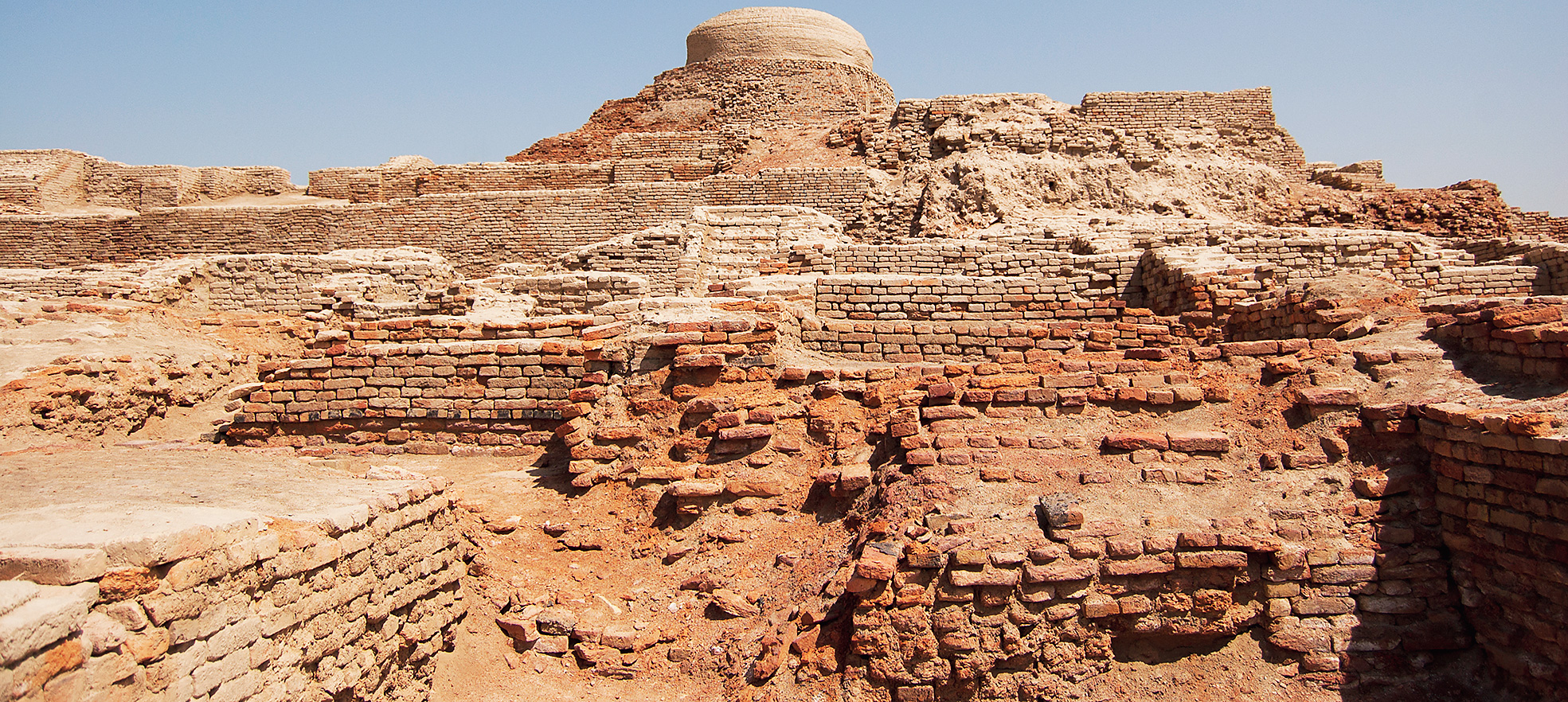
Archaeologists have excavated hundreds of Harappan settlements dating from 5,000 years to 3,200 years ago — or 3,000BC to 1,800BC — at sites close to the Indus river and across northwestern India. Textbooks, mythological tales and scientific papers have for decades proposed that large glacial-fed river systems — mainly the still-running Indus and the now-vanished Saraswati — had sustained the ancient civilisation. Some scholars have proposed that present-day seasonal rivers Ghaggar and Chautang are remnants of the mythical Saraswati’s network. But when that network dried up has remained unresolved.
Dave, now a research scholar at the Max Planck Institute for Chemistry in Germany, and her colleagues sought answers in quartz grains, or sand, extracted by Indian and French scientists in 1992. The researchers also analysed the spatial distribution of 570 Harappan sites along the Indus and 737 sites along the Ghaggar.
Collaborating with Ashok Singhvi at the PRL, Kathryn Fitzsimmons at Max Planck and Marie Agnes-Courty, a paleoclimate scientist in France, Dave assigned dates to the sand grains from the Ghaggar and Chautang using a technique called optically stimulated luminescence. While earlier studies had shown how the sediments along the paleochannels had changed over tens of thousands of years as the rivers lost their water over time, there were no firm dates for those changes.
“Everyone agrees there once was a big river there — the big question is when did it dry up,” says Dave. “Our results suggest that the river dried up many thousands of years before the emergence of even the earliest Harappan settlements.” The researchers have just published their findings in Quaternary Geochronology.
They aren’t the first to challenge the link between Harappan settlements and rivers. Two years ago, scientists at the Imperial College, London, and the Indian Institute of Technology, Kanpur, had shown that a major Himalayan river, the Sutlej, used to flow along the Ghaggar channel but changed course upstream 8,000 years ago. The study by Imperial’s Sanjeev Gupta, IIT-K’s Paul Debajyoti and colleagues suggested that when the Harappans established settlements in the area, there was only a seasonal, monsoon-fed river. The work, published in Nature Communications, suggested that ancient urban centres did not need a round-the-year flowing river to thrive.
And seven years ago, geologist Liviu Giosan at the Woodshole Oceanographic Institute in the US and his colleagues had also argued in a research paper published in the Proceedings of the National Academy of Sciences that the Saraswati did not water the Harappan civilisation.
The new work by Dave and her collaborators bolsters the evidence through the first direct dating of sediments along the Chautang paleochannel, which is the likely path for what was once a westward-flowing Yamuna. The sediment mineralogy in the Chautang resembles that from the Yamuna, which now flows east.
Their analysis shows that the Yamuna most likely flowed westward through the Chautang paleochannel and joined the Ghaggar downstream over 41,000 years ago. Dave says the change from a big and mighty river to an ephemeral or seasonal one occurred between 45,000 and 24,000 years ago, most likely 41,000 years ago. “And for the past 24,000 years, the general landscape is what we see today,” she says. To put that in context, the first Harrappan settlements were built 5,000 years ago.
Their analysis of the distribution of the 570 settlements along the Indus and 737 settlements along the Ghaggar also does not reveal a uniform “along the river pattern”. The positions of the settlements change over time — more widely distributed during the early Harappan phase, but concentrated around the confluence of tributaries or northward near the source of the rivers during the mature and late Harappan phase — indicating a preference for setting up settlements near sources of water.
“The site distribution along the Indus too is uneven — we believe factors other than the river influenced the decision of where to establish settlements,” says Dave.
The researchers say their findings are consistent with earlier suggestions that Harappans likely relied on groundwater, water harvesting and followed sustainable farming under a limited and seasonal supply of water — from a river whenever available, but also the monsoon rains.
Their study is, however, unlikely to quickly settle the debate. Khadg Singh Valdiya, a senior geologist in Bangalore — who has long argued that the Saraswati was a “wayward and wild river” that changed its course many times — says he is not impressed by the dating study. “Such dating only means the water had dried up in the specific channel from where the samples have been taken — but the Saraswati has changed its course many times over thousands of years,” Valdiya said.