
A storm that West Bengal counted on for rain has so far only led to scorching conditions.
On Wednesday, Met officials ruled out any change in the near future, even when the storm hits land in the form of a cyclone.
Cyclone Mocha — the name given by Yemen — is likely to hit land between Cox’s Bazar (Bangladesh) and Kyaukpyu (Myanmar) around the forenoon of May 14, according to the Met forecast. The zone is too far from the West Bengal coast for the storm to have any significant impact on the state, said Met officials.
On the sea, the system is drawing hot winds from northwestern India. The winds are travelling via West Bengal and pushing the Celsius up, said Met officials.
“It is likely to do so till it hits land. That means there is no respite from heat for Bengal for the next few days,” said G.K. Das, director, India Meteorological Department, Kolkata.
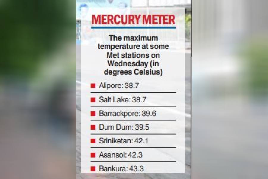
On Wednesday, Bankura, which saw the Celsius soar to 43.3 degrees Celsius, was hotter than Jaisalmer in Rajasthan, where the maximum temperature was 42.4 degrees.
The Met office recorded a maximum temperature of 38.7 degrees Celsius in Alipore and 39.5 degrees in Dum Dum. Multiple districts saw the mercury soar past the 40-degree mark (see chart).
Scattered thunderstorms are likely in the coastal districts of South and North 24-Parganas and East Midnapore on May 13 and 14. Some rain is not ruled out in Kolkata.
Some moisture-laden easterly winds from the outer band of the cyclone might reach the Bengal coast and trigger scattered thunderstorm activities during the weekend, said Met officials.
But the Celsius is likely to be higher than usual, in the city and the districts, before and after the showers, if any.

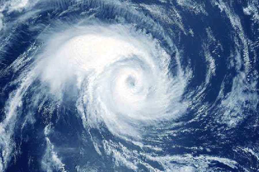
The system over the Bay of Bengal that is tipped to intensify into a cyclone was a deep depression on Wednesday morning.
The two ends of the expected landfall zone, Cox’s Bazar in Bangladesh and Kyaukpyu in Myanmar, are around 375km and 650km, respectively, from the Bengal coast.
“The distance between Cox’s Bazar and Kyaukpyu is around 300km. The storm is expected to hit land anywhere in that zone. But the nearest possible spot from Kolkata is Cox’s Bazar, which is around 400km away. The landfall area will be too far from the city to have any formidable impact here,” said Das.
The storm is expected to unleash winds clocking 130kmph at the time of landfall.
“The sea is going to be very rough. We have asked fishermen not to venture into the sea in the next few days. But on land, the Bengal coast is unlikely to see any impact as such,” said Das.
In Kolkata, Tuesday was sweatier than the past few days, leading to a rise in the discomfort index. Around 2pm, the website of AccuWeather, a US-based forecasting agency, showed a temperature of 39 degrees and a RealFeel of 51.
“The districts of south Bengal are likely to experience hot and dry weather over the next few days. The heatwave conditions in the districts are unlikely to abate soon. Once the system on the Bay is gone, a fresh system on land is likely to bring rain and relief. But not anytime soon,” said a Met official.
The deep depression, which was over the southeast Bay of Bengal on Wednesday, has started moving briskly, Met officials said.
“The deep depression over southeast Bay of Bengal lay centered at 11.30am today over the same region…. It is very likely to move north-northwestwards and intensify gradually into a cyclonic storm over the same region by tonight,” said a Met bulletin on Wednesday evening.
“Then continuing to move north-northwestwards, it will gradually intensify further into a severe cyclonic storm by 11th May morning and very severe cyclonic storm by mid-night over southeast and adjoining central Bay of Bengal.
“Thereafter, it is likely to recurve gradually, move north-northeastwards from 12th May morning. It is likely to weaken slightly from 13th May evening and cross southeast Bangladesh and north Myanmar coasts between Cox’s Bazar (Bangladesh) and Kyaukpyu (Myanmar) around forenoon of 14th May with maximum sustained wind speed of 110-120kmph gusting to 130kmph.”