Over 50 illegal structures have officially been identified on the upper Bagjola canal in northeast Kolkata impeding the flow of water, senior officials of the irrigation department said after a recent assessment of the water carrying capacity of the outlet ahead of the monsoon.
The canal is one of north Kolkata’s key drainage outlets.
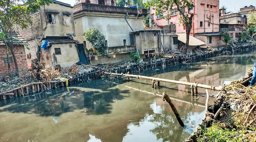
A majority of these structures have come up on garbage dumped along the sides of the canal for years that has reduced the canal’s width to 15 metres along some stretches from 21 metres, the officials said.
“These structures have come up close to 10 feet into the canal by a section of local residents who have been dumping solid waste for years. A majority of them stand on areas that come under the jurisdiction of Baranagar and South Dum Dum municipalities,” said a senior official of the irrigation department.
“We have sent letters to the concerned municipalities and police stations asking them to take necessary steps for removing the structures so we can regain the volume of the canal as laid down in the original design.”
The 38km-long Bagjola canal carries water from BT Road in Kamarhati in the west, cuts through parts of Baranagar, Dum Dum, Lake Town and New Town to carry water to the Bidyadhari river in the east.
To ensure better management, the irrigation department has split the canal into two halves. The upper Bagjola canal spans 9.23km from the origin till VIP Road. The lower canal stretches 28.8km from VIP Road till it meets the Bidhyadhari river.
A team of senior engineers from the irrigation department who scanned the upper Bagjola canal recently said nearly 15 per cent of the total stretch has been taken up by illegal encroachment.
“Several cowsheds, spanning close to 150 metres, have come up along the bank of the Bagjola canal near Hanuman Mandir in South Dum Dum. The effluents from these cowsheds including cow dung and straw contribute to clogging the canal,” said a senior engineer.
“We have met owners of these illegal cowsheds and have asked them to shift. They have been non-cooperative so far.”
The upper Bagjola canal flows through the jurisdiction of at least four civic bodies, including Baranagar, Kamarhati, South Dum Dum and Birati, which comprise some of the densely populated areas of the city’s north.
Water from the upper canal is discharged to the lower portion that cuts through parts of the Bidhannagar Municipal Corporation, Rajarhat and New Town, Bhangarand Haroa in North 24-Parganas.
The state government has set a March deadline for completing the work of dredging the whole canal at an estimated cost of around Rs 60 crores. Once the work is completed, water from parts of Kamarhati, Baranagar, Dum Dum, Lake Town, Baguhati and its adjoining areas will flow down the Bagjola canal at a higher speed.
“We have set a target of carrying over 46,000 litres of water per second down the lower Bagjola canal. If lowerBagjola succeeds in pumping out more water, then the upper part of the canal will be able to carry a bigger volume of storm water,” the official said.