We’ve watched boulders rolling down mountainsides crushing cars, swirling floodwaters sweep away bridges and TV reporters waist-deep in muddy waters breathlessly filing their monsoon reports.
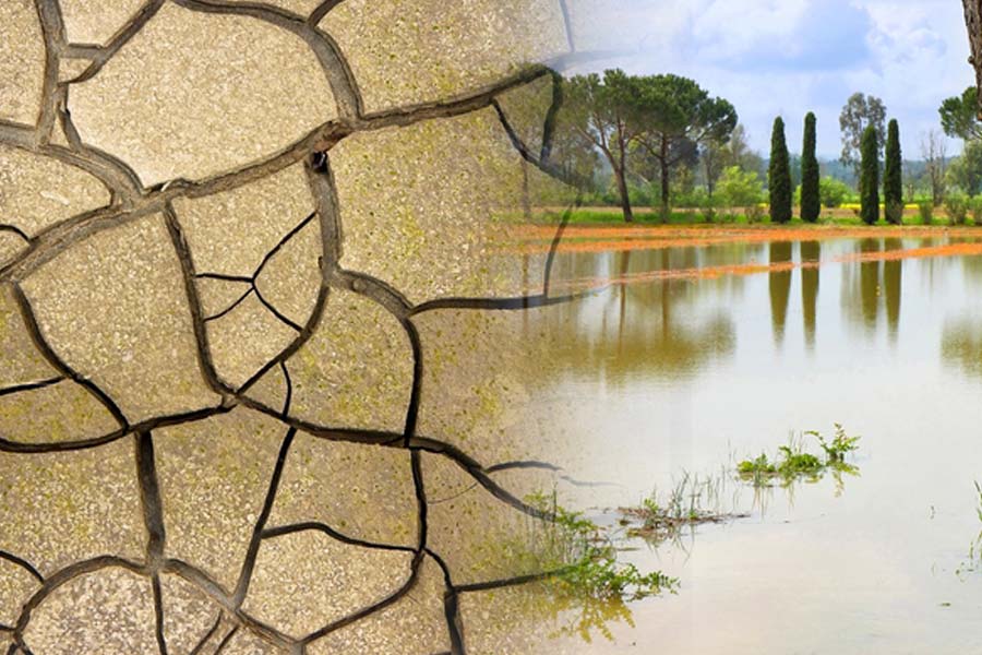
But the harsh news is that half the country is facing huge rainfall shortages. “It’s drought-like conditions in many parts of south India,” says Air Vice Marshal Gurparshad Sharma, president, Skymet Weather. In Kerala and North Karnataka, there’s a rainfall deficit of 35 per cent and south India, as a whole, is short by a huge 22 per cent.
“Kerala is supposed to be the rainiest pocket of India and it is terribly deficit in rainfall,” says Sharma.
A similar story is playing out in West Bengal, Bihar, East Uttar Pradesh and Orissa where this season’s rains are 20 per cent to 40 per cent below what they should have be at this stage of the monsoon. Jharkhand is the worst-affected with a 45 per cent shortfall.
Only northwest India which has been lashed by heavy downpours over the last week is now actually in surplus. But those pounding rains have pushed the rainfall excess for the entire country to 2 per cent.
While the eastern and northeastern region has recorded a deficiency of 17 per cent, north India overall has witnessed 59 per cent excess rainfall, IMD data shows. Central India, where a large number of farmers rely on monsoon rains, has recorded an excess of 4 per cent.
“The centre of India is just about okay. You can call it a skewed distribution,” says Sharma, who earlier headed the Air Force’s weather forecasting unit.
Chandigarh was battered by an extraordinary 322mm of rainfall in just 24 hours which was by far an all-time record for the city. Similarly, Gujarat, which received the full force of the cyclone earlier in the season and another weather system after that, has received sufficient rainfall so far in the season.
That’s a sharp contrast from regions like Kerala which should receive 992.6 mm of rain between June 1 and now. Instead, it has received only 639,4 mm which is 36 per cent short of the normal. “In Kerala, it’s supposed to rain every day in July and out of that time it should rain heavily. But it has rained heavily only on a couple of days,” says Sharma.
July is usually the key month for the monsoon all across the country. In Northern India, the effective monsoon months are usually in July and August. The east, by contrast, gets four months of rain which can even spill over into October. In June, the rains were below normal in most parts of the country.
“July is the most crucial month. The rainiest month for any pocket in India is July as that is when there is 35 per cent of the seasonal rainfall,” says Sharma.
The record rains in the north and the rain shortfalls in the south means that farmers are struggling all over the country. In Haryana, the excessive heavy rain has led to farmers losing their rice and other crops.
In places like Himachal Pradesh which has been hit by both landslides and heavy flooding, large swathes of the apple orchards have been destroyed. And regions like Coorg have been hit by the rainfall shortage in the Cauvery Basin area. “In the south the crops have been damaged because of drought and deficiency. In the north, the crops have been damaged because of the deluge. In the East there’s a 13 per cent to 14 per cent deficit,” says Sharma.
The erratic and uneven rains mean uncertainty, not only for summer-sown staples like rice, but also for the harvest of wheat, oilseeds and vegetables. “You need a decent distribution of rainfall,” says Sharma.
The prices of tomatoes, for instance, have soared to an unprecedented Rs 250 a kilo in Delhi and elsewhere. Farmers, who normally plant summer crops in the months of June and July, have fallen behind in planting crops due to the uneven rainfall distribution. Just 35 million hectares have been planted, down 9 per cent from the same time last year.
Skymet had predicted a slightly below normal monsoon of 94 per cent with a plus or minus 5 per cent possibility either way. This was just slightly below the Indian Meteorological Department’s prediction of 96 per cent, plus or minus 5 per cent. The monsoon rain arrived on June 8, their longest delay in more than four years.
Sharma still believes the El Nino, a weather phenomenon that occurs every two to seven years and results in more hotter, drier spells, will play a role and reduce this year’s monsoon.
He believes there’s a strong chance the monsoon will slow down and says: “I feel it could collapse or at least it is going to halt. The monsoon does have active and passive sequences.” He adds: “By July-end it will become clearer which way it is going to swing.” Droughts have occurred in India in five of six El Nino years since 2000, Skymet noted in a statement. There were “severe droughts” in two of those years and a “near drought” in the last El Nino year in 2018.