North coastal Tamil Nadu and Puducherry are expected to experience light to moderate rainfall in most places and isolated heavy rainfall on Tuesday morning, decreasing thereafter, according to the latest IMD bulletin.
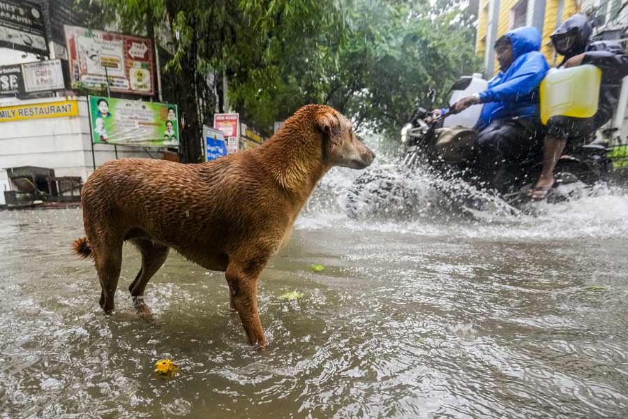
The forecast of reduced rainfall intensity comes as a relief after Cyclone Michaung wreaked havoc across Chennai and adjoining districts, causing flooding and disrupting normal life on Monday.
Residents in some parts of Chennai reported no rain since early hours on Tuesday and mentioned that power services had been restored in those areas. However, train services to and from the city remain suspended.
The latest bulletin from the India Meteorological Department (IMD) states that coastal Andhra Pradesh will also continue to receive light to moderate rainfall at most places. Heavy to very heavy rainfall is expected at a few places with extremely heavy falls at isolated places over coastal Andhra Pradesh and Yanam on Tuesday. Additionally, exceptionally heavy rainfall at one or two places is likely over north coastal and adjoining south coastal Andhra Pradesh on Dec 5.
As per the latest IMD bulletin, the Severe Cyclonic Storm Michaung (pronounced as Mig-jaum) over Westcentral Bay of Bengal off south Andhra Pradesh and adjoining north Tamil Nadu coasts moved north-northwestwards with a speed of 07 kmph during the past 06 hours. At 0230 hours IST on Tuesday, it was centered 20 km north-northeast of Nellore, 170 km north of Chennai, 150 km south of Bapatla, and 210 km south-southwest of Machilipatnam.
The bulletin noted that as the system is nearly moving northwards close to the coast, some parts of the wall cloud region lie over land.
The cyclone is likely to move nearly northwards parallel and close to the south Andhra Pradesh coast and cross the south Andhra Pradesh coast between Nellore and Machilipatnam, close to Bapatla during the forenoon of Tuesday as a Severe Cyclonic Storm with a maximum sustained wind speed of 90-100 kmph, gusting to 110 kmph, the bulletin added.
Except for the headline, this story has not been edited by The Telegraph Online staff and has been published from a syndicated feed.