The western Himalayan region is likely to experience the first spell of heavy snowfall this season under the influence of two back-to-back western disturbances starting Sunday, the India Meteorological Department (IMD) said on Saturday.
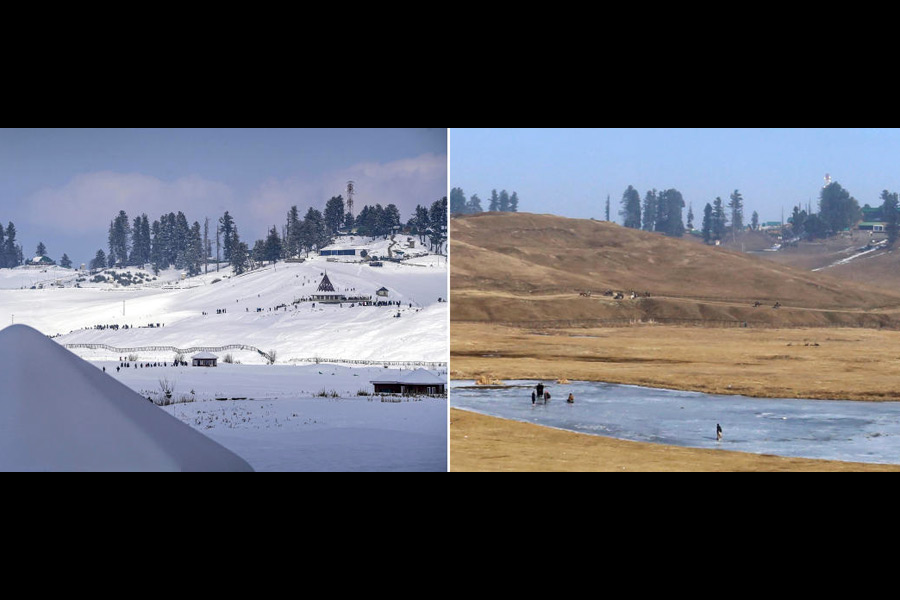
Mountain peaks in the western Himalayan region have so far remained noticeably bare this winter season, with the IMD attributing it to the lack of active western disturbances (WDs) -- weather systems that originate in the Mediterranean region and bring unseasonal rainfall to northwest India.
The lack of active WDs can also be attributed to the prevailing El-Nino conditions, abnormal warming of surface waters in the central Pacific Ocean.
The precipitation deficit is likely to impact fresh water availability in the Himalayan region, further affecting horticulture and agricultural production, Sonam Lotus, the head of the meteorological centre in Leh in Ladakh, said.
The IMD on Saturday said a fresh western disturbance is likely to affect the western Himalayan region starting Sunday and another WD is likely to affect the region and adjoining plains of northwest India from January 31.
Under the influence of these systems, isolated heavy rainfall/snowfall is likely over Jammu and Kashmir, and Ladakh between January 28 and January 31.
"Light/moderate isolated to scattered rainfall/snowfall is very likely over Uttarakhand and light rainfall over Punjab, Chandigarh, Haryana, west Uttar Pradesh from January 31 to February 2," the Met office said in a statement.
Except for the headline, this story has not been edited by The Telegraph Online staff and has been published from a syndicated feed.