Summary
IIT Guwahati start-up Drones Tech Lab will be deploying drones equipped to tackle wind speed
The survey will help in relief and rescue work and aid evacuation
The Indian Institute of Technology (IIT), Guwahati, will help the Assam government survey the flood-affected areas of the states by using drones developed by its start-up to aid relief and rescue work.
The Assam government reached out to IIT Guwahati and sought its expertise for surveying flood-affected areas using drones to assess the condition in the villages where road connectivity has been disrupted because of heavy flow of water.
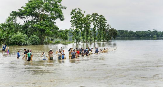
The flood situation in Assam remained extremely critical on Sunday with many new localities coming under the impact of the deluge in several districts of the state and overnight incessant rain inundating more areas in Guwahati.
Torrential rains for the past week have thrown normal life out of gear in parts of Assam. Landslides have also been reported from another half a dozen places in the city, including Kamakhya, Kharghuli, Hengerabari, Silpukhuri and Chandmari Colony.
“The government has approached us and we will be beginning work as soon as possible. We will be using drones to survey the affected areas. Also, this exercise is important to help the government develop an action plan to prepare better ahead of the monsoon season considering the area is prone to floods and landslides because of its geographic location,” said Parmeshwar Iyer, dean, IIT Guwahati.
“The drones will be used to conduct aerial survey of areas that have been severely affected and some villages where road connectivity has been disrupted because of heavy water flow. The exercise will be helpful in identifying areas where people could be stranded, immediate evacuation is needed and relief material needs to be provided,” he added.
Drones developed by IIT Guwahati start-up venture, Drones Tech Lab, have previously been used for faster data collection in several projects on land survey, river mapping, agriculture, healthcare and disaster management.
“One major challenge in surveying flood-affected areas with drones is the wind, hence drones equipped to withstand the wind speed are needed. These drones have been used in disaster management during flooding of Majuli island of Assam and for dengue prevention in Kolkata,” said Debajati Deka, co-founder, Drones Tech Lab.
“Before this, our drones have been used in Karnataka, Jharkhand, West Bengal, Assam and Meghalaya,” he said.
Last updated on 19 Jun 2022